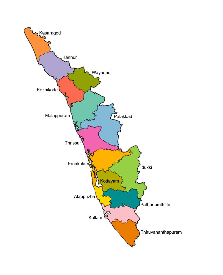
The state of Kerala is divided into 14 revenue districts. On the basis of geographyical, historical and cultural similiarities the state's districts are generally grouped into three parts :- The North Kerala districts of Kasaragod, Kannur, Wayanad, Kozhikode, Malappuram; the Central Kerala districts of Palakkad, Thrissur, Ernakulam, Idukki; and the South Kerala districts of Kottayam, Pathanamthitta, Alappuzha, Kollam, Thiruvananthapuram. Such a regional division occurred being part of historical Kingdoms of Kochi, Travancore and British Province of Malabar. The Travancore region was again divided into three zones as Northern Travancore (Hill Range) (Idukki and parts of Ernakullam), Central Travancore (Central Range) (Pathanamthitta, Alappuzha and Kottayam) and Southern Travancore (Southern Range) (Thiruvananthapuram and Kollam). The Malabar region was divided into North Malabar and South Malabar. The districts in Kerala are often named after the largest town or city in the district. The 14 districts are further divided into 75 taluks, and 941 Gram panchayats. Some of the districts were renamed in 1990 from the anglicised names to their local names.